
Biodiversity Capacity (BCAP) - A New, Scalable Approach to holistically measure nature outcomes
Market ready, backed by decades of scientific research on the relationship between an ecosystem’s structure & the life it can support
DEVELOPED IN PARTNERSHIP WITH

How it works

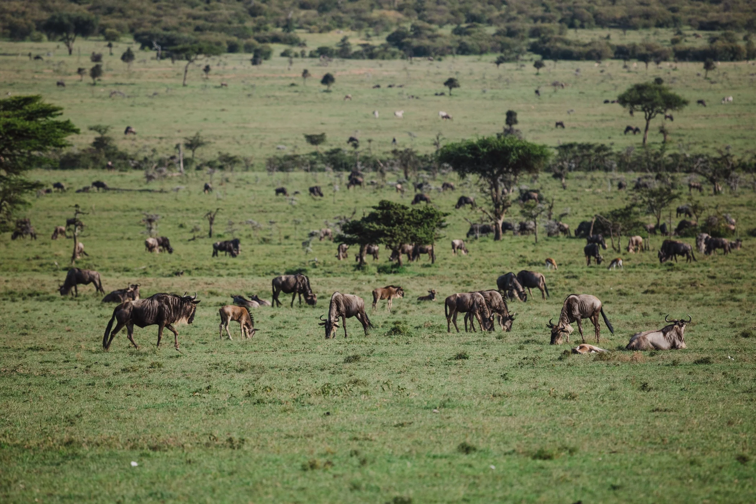
Everything starts with vegetation structure
Decades of research have shown strong relationships exist between the structure of an ecosystem's vegetation and the species that live within it.
In other words - the more diverse and complex an ecosystem’s plant life is, the greater it’s ability to hold different species of all kinds.

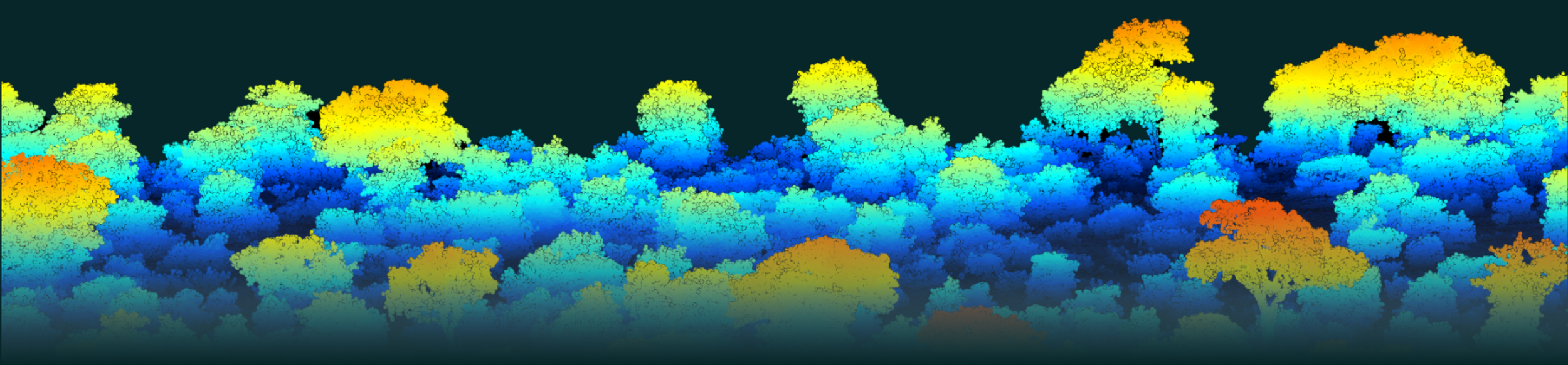
Remote sensing helps us capture the structure of ecosystems across millions of acres
A combination of satellite imagery and drone-based LiDAR sensors allow us to measure fine-scale vegetation structure as a reliable proxy for overall biodiversity.
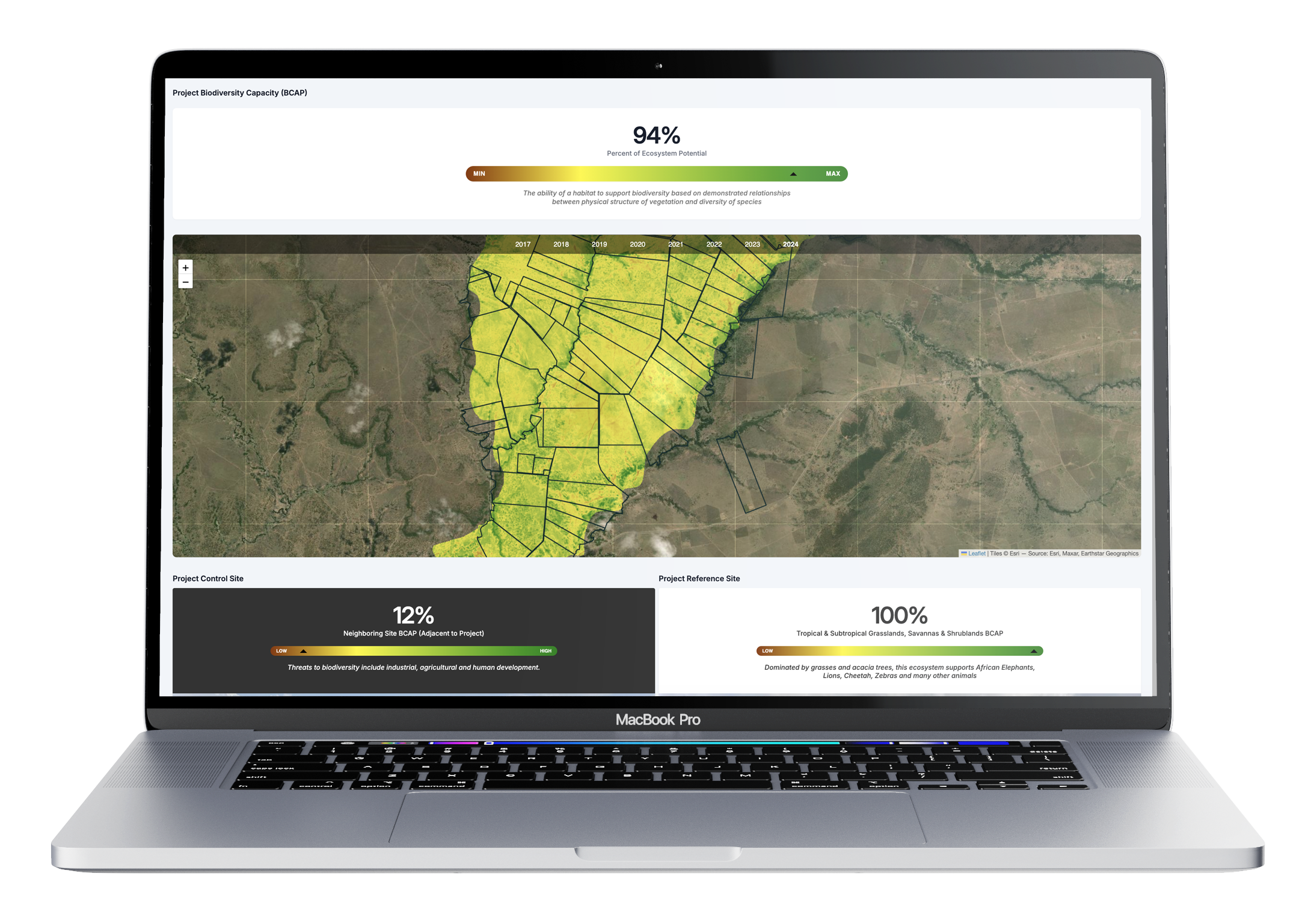
Finally, to make sense of the results, each site is compared to reference and control sites
In order to understand the impact of interventions on a given project site, we compare the site with itself over time, and with other sites at any given moment. BCAP scores are relative, so a pristine environment would score 100, while a degraded urban landscape would score 0.
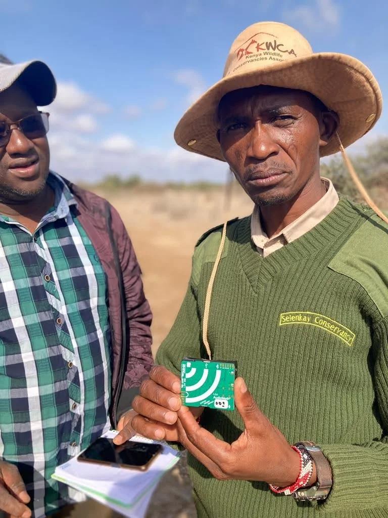
Then, ground measurements are used to refine our measurements
On-site measurements are used to validate and improve the accuracy of our biodiversity models - including records by members of the community, camera traps and bioacoustics monitors.
BCAP Advantages
Implementing BCAP measurement at scale is a revolutionary unlock for those looking to understand how changes in land use and other interventions impact biodiversity.
While we’ve known how to measure biodiversity for a long time, conventional approaches have presented a challenge: they tend to revolve around direct measurements and surveys which are:
slow
static,
expensive,
cover tiny areas often limited to fractions of an acre, and
require a village of highly specialized technical professionals, limited to a few taxa groups.
BCAP addresses all of these challenges with a combination of remote sensing and digital ground sensors, pairing local knowledge of the land with scientific rigor to deliver market-ready, credible measurements of nature outcomes.
BCAP FAQ
-
Biodiversity is the diversity of all life on Earth. An area with high biodiversity has both more species and individuals of each species relative to somewhere with low biodiversity. For example, old growth rainforests have high biodiversity levels; monoculture farmlands tend to have low biodiversity levels.
-
Structural diversity refers to the physical complexity of an ecosystem, especially in terms of its three-dimensional features like height, layering, and spatial variation in vegetation. It includes elements such as: canopy height and layering (e.g., tall trees, understory shrubs, ground cover), branch density and arrangement, openings or gaps in the canopy. Variations in plant types and sizes across horizontal and vertical space.
In simple terms, it’s about how “stacked” and “varied” the physical layout of an ecosystem is. Greater structural diversity typically means more ecological niches, which can support more species, especially those that don’t shape the structure themselves (like many birds, insects, and small mammals). That’s why it’s a useful proxy for estimating biodiversity capacity. -
By looking at ecosystems holistically and functionally rather than on identifying specific species as benchmarks, we avoid pitfalls that can come from focusing on optimizing single species. BCAP is complementary with projects focused on umbrella or frontier species by ensuring there’s active monitoring for the desired outcome of greater biodiversity, not proliferation of single species.
Additionally, this is a more scalable and cost-efficient way to ensure that biodiversity measurements can be made by key market players. By leveraging remote sensing, BCAP is a cost effective and accurate proxy for nature that can be scaled across millions of acres within a given ecosystem type, as it simplifies the number of tools and time required to assess the impact of an intervention on biodiversity. In contrast, conventional methods use dozens of different instruments that often are limited to measuring less than an acre at a time. -
EarthAcre uses BCAP to provide funders with a proven, scientific and cost-efficient way to measure the impact of nature finance, and for project developers to understand the effectiveness of their interventions and use of funds. It is used in conjunction with EarthAcre's system of tracking direct payments to the individuals contributing to nature projects.
BCAP allows funders not only to understand the impact of their dollars - it also allows them to visualize how each dollar has contributed to a corresponding outcome. This ensures transparency and aligns incentives for all parties, derisking capital deployed and amplifying impact. -
BCAP is compatible with other widespread scientific indicators on biodiversity, such as the Shannon diversity Index. Contact us to learn more.
-
EarthAcre works closely with the Davies lab at Harvard University. Listen to Professor Davies about BCAP at the video on this page